Darbyshire - Derby, Chesterfield, Glossop, Ilkeston, Long Eaton, Swadlincote, Buxton, Matlock, Ashbourne, Chapelen, Dove's Hole)
High Peak: High Peak is also known as the parish of grand halls because it is a remnant of a time when houses and estates were frequently and freely granted in return for services to the Royal Crown. The lucrative forestry and hunting and mineral rights of the area can make a landowner a wealthy man.
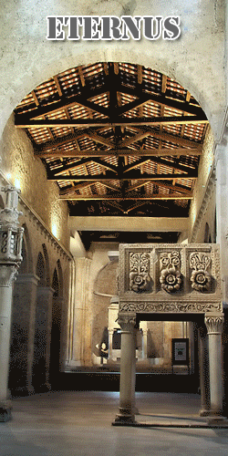
Chapelen: (Chapelen or Chapel-en-le-frith) - The castle here that is at the heart of the town stood abandoned for many years until the Duke of Staffordshire recently took up residence here and made it his vacation estate.
The first chapel in the town called the Church of St. Thomas stands at the highest point in the town. The church lies in ruins here and for some reason the regulars tend to avoid it.
There is a regular market place, cobbled and raised above the High Street. The market is still used day to host a different local market. A market cross lies in the center of the square that is remarkably similar to the one in the churchyard.
Dove's Hole: Dove Holes is a village in the High Peak district of Derbyshire that lies on the fringe of the Peak District National Park. It has a population of about 1,200. It lies three miles from Buxton and three miles from Chapel-en-le-Frith. Residents of the village live either in the village or on outlying farms. There are around six farms in the village and many more within the boundaries of the parish.
Quarrys: There are large limestone quarries that are also at the center of the economy of the area.
several businesses
a general store
Post Office
Lodging - Public Houses - There are two public houses which offer food and lodging.
Church -
Evidence of human occupation at Dove Holes can be traced back to the Neolithic Period (late Stone Age) because of the existence of a henge, known locally as The Bull Ring, and an adjoining tumulus. In medieval times the area was used as the Royal Hunting Forest of High Peak (now known as Peak Forest), an area set aside as a Royal Hunting Forest. The village name is believed to derive from the Deru word dwfr (dwr in Modern Welsh), which means water, hence Water Holes or Dove Holes. The same word is the origin of the name 'Dover' for our famous channel port.
In 1650, a General Survey of the Manor of High Peak was made to assess the property of the late King Charles. This recorded that people were burning limestone around the village and that there were 14 kilns thereabouts, the burnt lime (quicklime) being slaked and used by farmers to condition the soil in their fields. At that time, lime kilns could be built and demolished without authority.
With the coming of the Industrial Revolution, and the opening of the Peak Forest Tramway in 1796, the limestone quarries were commercialised. The first of these was at nearby Loads Knowl and others quickly followed along Dove Holes Dale. Undoubtedly, the opening of the Peak Forest Tramway and the consequent expansion of commercial limestone quarries contributed greatly to the expansion of the village. For the first time, there was an outlet for limestone in Manchester via the Peak Forest Tramway, Bugsworth Basin, the Peak Forest Canal and the Ashton Canal.
There is a Trent Barton bus garage on the east side of the A6, replacing the one which used to be in Buxton.
In 2001, the village was voted the Ugliest Village in Britain.[1]
Cemex operate a quarry in Dove Holes.
[edit] References
Bull Ring - This is the oldest monument in the parish and is an earthwork in the shape a large circle. It is known only as the Bull Ring.
This stone circle has a twin at Arbor Low that is key to unlocking their power.
Doves Hole Tramway: There is a tramway built by the local mining company to carry workers to the mines and to carry the stones from the quarries of Dove Holes to the terminus of the Peak Forest Canal at Bugsworth. The carts are horse drawn for much of the journey, but a revolutionary gravitational railway was used on the steepest section, whose path can be traced on the eastern boundary of the town of Dove Hole.
Heafield - Heafield is an abandoned village and civil parish in the Borough of High Peak, in the county of Derbyshire. The civil parish includes Heafield village itself, along with Little Heafield and part of Birch Vale.
This once prosperious village is now abandoned save for the haunted spirits that frequent the area or the bandits that brave its horrors.
"Alleged Raising of Spirits at Heafield"
"I know you are pleased with anything curious and uncommon in nature and if what follows shall appear such, I can assure you from eyewitnesses of the event of every particular. In a church at about three miles distance from us, the indecent custom still prevails of burying the dead in the place set apart for the devotions of the living, yet the parish not being very populous one would scarce imagine the inhabitants of the grave could be strained for want of room, yet it would seem so for on the last of August, hundreds of bodies rose out of the grave in the open air in that Church to the great astonishment and terror of several spectators. They deserted the coffin and rising out of the grave immediately ascended directly towards Heaven, singing in consert all along as they mounted through the air.
"They had no winding sheets about them yet did not appear quite naked, their vesture appeared streaked with gold, interlaced with sable, skirted with white yet thought to be exceeding light by the agility of their motions and the swiftness of their ascent. They left a most fragrant and delicious odour behind them but were quickly out of sight and what is become of them or in what distant region of this vast system they have since fixed their residence no mortal can tell.
"The church is Heafield, three miles from Chappell Frith, 1745" (the Bulls Head Inn is next door to the Church)
Bull's Head Inn - Small but well respected and comfortable Inn house near the church gates. (Abandoned)
Special: A hidden room in the back of the inn teleports you to the identical but abandoned inn in Heyfield and vice versa. Haunted by a powerful evil spirit.
High Peak Forest - Surrounding city of Chapelen - this very fertile hunting ground was the reason for the founding of the town which was at one time a hunting lodge for nobility.
Dark Peak - To the north of Chapel lies Dark Peak. They are rugged and bleak mountains with little wildlife or other activity. It is famous for the Dark Chasm that is found between the two largest mountains.
White Peak - To the south is the gentler grasslands of White Peak, It is known for its amazing bluffs and gorges.
Eccles Pike is situated to the south-west and rises to a height of 1,250 ft above sea level and offers excellent views of the area.
Dark Peak Chasm – This huge rift is almost a mile wide at points. No one knows exactly how deep it goes but many speculate it descends into the depths of the Down Below and beyond. Adventurers have uncovered many mysteries in this area including ancient ruins in the upper levels and hidden temples of ancient power in the lower levels among other things. One thing that remains a mystery is the source of the vicious creatures called Dredgewalkers that often mysteriously appear from the pit to wreck havoc on the surrounding villages.